Washington, DC · United States · WMATA
Leidaro shows every Metrobus in Washington, DC on a live map. Tap a stop to see when the next bus actually arrives — straight from WMATA's open GTFS data.
Freemium. Core features included. No account. No ads.
01 · Public transport in Washington, DC
Washington runs one of the biggest bus networks in the United States: Metrobus crosses the District and reaches deep into Maryland and Virginia, and it keeps running when the subway does not.
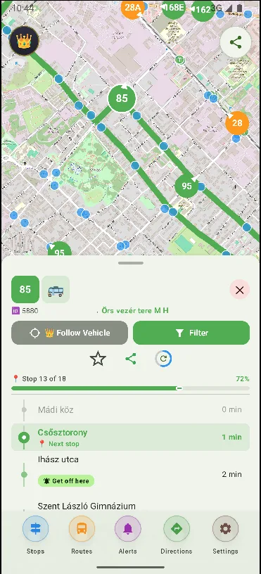
Leidaro pulls live vehicle positions directly from the same public feeds that WMATA publishes. Every bus on the map is exactly where it is right now. Tap a stop and see the next arrivals with real countdown times.
A Metrobus ride is $2.25 wherever you board, and transfers between buses are free within two hours. Pay by tapping a SmarTrip card, a phone or a contactless bank card on the farebox — or use exact cash.
WMATA's bus network covers 126 routes and about 7,500 stops across Washington, Arlington, Alexandria and the Maryland suburbs, including the 7th Street and Georgia Avenue corridor that carries the D40 past Howard University.
Leidaro was built for public transport that publishes open data. In Washington it uses WMATA's public GTFS schedule and real-time vehicle feed to show the exact position of every Metrobus.
Download the city once and the static map data (stops, routes and directions) works even without internet. Set up alerts for your daily routes and save your favorite stops.
Freemium. Core features included. No account. No ads.
02 · How it works
A small download from the Play Store. No sign-up screen on first launch.
Or let it find you. The map loads in a couple of seconds.
A stop for arrivals. A vehicle to follow. A route to see the whole journey.
03 · Questions
Yes. Leidaro uses the same public GTFS feed that WMATA publishes for Metrobus, so it covers all 126 bus routes and their 7,500 stops across DC, Maryland and Virginia.
Not currently. The Washington feed Leidaro downloads is WMATA's bus GTFS, so the map shows Metrobuses live. Metrorail is published by WMATA as a separate rail feed.
Absolutely. Download Washington once and all routes, stops and timetables work without a connection.
Yes, the core features are included in the freemium plan, with no ads and no account needed.
Not yet — Leidaro is an Android app (Android 7.0+). If an iOS version happens, you'll hear about it here first.
Vehicle positions and countdowns come straight from WMATA's real-time feed, so you see where the buses actually are — usually only a few seconds behind reality.
No. Leidaro is an independent app built by Minrax. It is not affiliated with WMATA, the District of Columbia or any other transit agency — it uses the public GTFS data WMATA publishes.
No. Metrobus fareboxes also accept contactless bank cards and phones, and cash is an option. Leidaro itself needs no account, card or ticket.
04 · Washington, DC's bus network
Metrobus is WMATA's bus network: 126 routes and roughly 7,500 stops spread across the District of Columbia, Arlington and Alexandria in Virginia and Montgomery and Prince George's counties in Maryland.
Most routes funnel into downtown — the 7th Street, Georgia Avenue and Connecticut Avenue corridors among them. The D40 links the National Archives with Howard University and carries on towards the Maryland line.
With Leidaro you see this entire bus network live — every Metrobus on one map.
The GTFS data comes from WMATA, which publishes both the static bus schedule and a real-time vehicle-position feed as open developer data.
Download Leidaro, find your stop and see the next arrival in seconds.
Get it on Google Play