London · United Kingdom · TfL
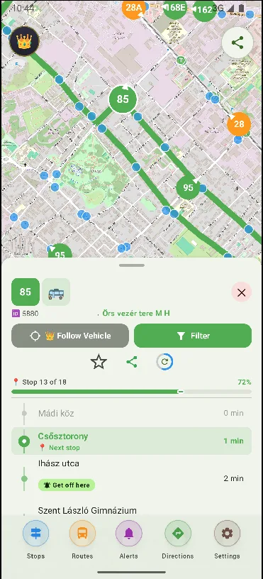
Leidaro shows every bus, tube and tram in London on a live map. Tap a stop to see when the next vehicle actually arrives — straight from the open TfL data feeds.
Freemium. Core features included. No account. No ads.
01 · Public transport in London
London's transport network is one of the most complex in the world. But knowing when your bus actually arrives has always been the tricky part.
Leidaro pulls live vehicle positions directly from the same public data feeds that Transport for London publishes. Every vehicle on the map is exactly where it is right now. Tap a stop and see the next arrivals with real countdown times.
London runs on contactless: tap in and out with Oyster or a bank card and daily and weekly fare capping does the maths for you. Bus and tram hops are a flat fare, and you can change buses free for an hour.
The network counts 11 Underground lines, the DLR, Overground, the Elizabeth line and around 700 bus routes — plus the Night Tube on Fridays and Saturdays. For sightseeing, the top deck of a bus beats the tube every time.
Leidaro was built for public transport in the UK. It uses Transport for London's open data to show the exact location of every vehicle.
Download the city once and the static map data (stops, routes and directions) works even without internet. Set up alerts for your daily routes and save your favourite stops.
Freemium. Core features included. No account. No ads.
02 · How it works
A small download from the Play Store. No sign-up screen on first launch.
Or let it find you. The map loads in a couple of seconds.
A stop for arrivals. A vehicle to follow. A route to see the whole journey.
03 · Questions
Yes. Leidaro uses the same public GTFS data feeds that Transport for London publishes, so it covers all bus, tube and tram lines in London.
Absolutely. Download London once and all routes, stops and timetables work without a connection.
Yes, the core features are included in the freemium plan, with no ads and no account needed.
Not yet — Leidaro is an Android app (Android 7.0+). If an iOS version happens, you'll hear about it here first.
Vehicle positions and countdowns come straight from the operator's real-time feed, so you see where things actually are — usually only a few seconds behind reality.
No. Leidaro is an independent app built by Minrax. It is not affiliated with Transport for London — it uses the public GTFS data the operator publishes.
The map downloads only small position updates, so data use is modest. Like any live map, continuous GPS use costs some battery — but there are no ads, trackers or background uploads.
Freemium: core features included: live map, arrivals, alerts, favourites and offline cities. An optional upgrade lifts the free-tier limits and supports development. No ads, either way.
04 · London's transport network
London's transport network is vast: the Underground (the world's first underground railway, opened in 1863) runs on 11 lines, while TfL buses serve over 700 routes across the capital.
From the iconic red double-deckers crossing Westminster Bridge to the Docklands Light Railway and the Elizabeth line, London's network moves over 5 billion passengers every year.
With Leidaro you see this entire network live — every bus, tube, tram and DLR train on one map.
The GTFS data comes from Transport for London (TfL), the integrated transport authority responsible for most of the capital's network — the Tube, buses, trams, DLR, London Overground and the Elizabeth line.
Download Leidaro, find your stop and see the next arrival in seconds.
Get it on Google Play